Tenaya
July
2013
Part Three
Hinchinbrook Channel
to Cairns
| |
| HOME |
| About Tenaya |
| About Us |
| Latest Update |
| Logs from Current Year |
| Logs from Previous Years |
| Katie's View |
| Route Map |
| Links |
| Contact Us |
![]()
July 9, 2013
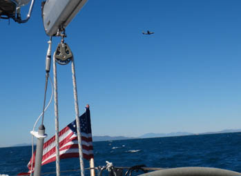
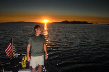
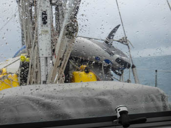
"The yacht south of the Palm Islands, this is Army Shark Hat," the VHF radio blares. I look around. There are no other yachts.
"Army Shark Hat, this is yacht Tenaya. Over," I say into the handset.
Tenaya, this is Army Shark Hat, we are doing exercises in the area, do you see smoke? Over."
"Army Shark Hat, this is Tenaya. No, I don't see any smoke. Over."
"Tenaya, this is Army Shark Hat. What is your heading?"
"Army Shark Hat, this is Tenaya. Our heading is two nine eight True. Over."
"Tenaya, this is Army Shark Hat. Looks like you are heading to the west side of the Palm Islands. There is a life raft directly on your course and we are dropping things to it. We don't want to drop anything on your yacht. Over."
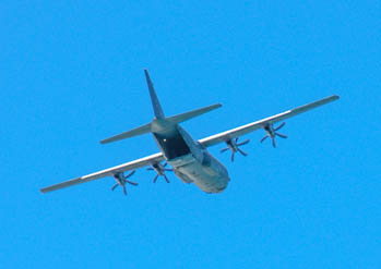
As he talks I scan ahead with the binoculars. There is a yellow life raft ahead, below the lumbering plane that is coming straight at us.
"Army Shark Hat, this is Tenaya. I appreciate that. I see the life raft now. Would you like us to alter course? Over."
"Tenaya, this is Army Shark Hat. Excellent. Yes, head north to Palm Islands. If our drop is successful I'll let you resume your course. Stand by."
I adjust the autopilot to 360T and the sails flapper wildly as we head directly downwind. No time to mess with them, Jim hops in behind me to roll in the jib, straighten out the boom and turn on the engine. My eyes are focused on the life raft and plane. Steve stands on deck, out of our way.
The plane has circled around and is approaching again, lower this time. As I watch through the binos I see four splashes next to the life raft. In seconds the aircraft is directly overhead.
When we don't hear back for fifteen minutes Jim plots a different course through the islands.
"Yacht Tenaya, this is Army Shark Hat."
"Army Shark Hat, this is yacht Tenaya. Over."
"Tenaya, this is Army Shark Hat. You may resume your course now. Over."
"Army Shark Hat, this is Tenaya. Thank you and thanks for the show."
"Tenaya, this is Army Shark Hat. Glad you enjoyed it," he says with a chuckle. "Army Shark Hat out."
"Tenaya out."
We tossed off the docklines at 0620 that morning. It was just light enough to see. Tenaya hummed down the creek and was passed by two of the ferries that run unendingly between Townsville and Nelly Bay at Magnetic Island. It was low water on a springs tide so we dared not go out of the channel.
Our destination lay 62 miles north, Orpheus Island. At an average of 5 knots it would take us all day.
We were pleased when the winds kicked up to 20 knots at 0730 and we sailed nicely, under sunny skies, right on course.
The chart says the area north of Magnetic Island is used for military exercises. Sure enough, there was a big prop doing laps up ahead. Then Army Shark Hat called us.
July 2 - Little Pioneer Bay, Orpheus Island
18 35'.84S 146 29-.18E
That night, safe in our anchorage at Little Pioneer Bay, I read Lucas' guidebook about the area. Whoops. We were supposed to stay far away if there were any signs of military action. Chalk up one dummy move for the Yanks.
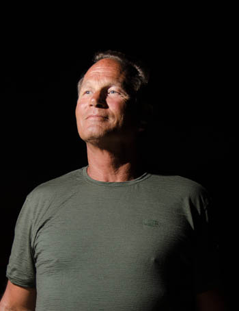
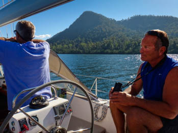
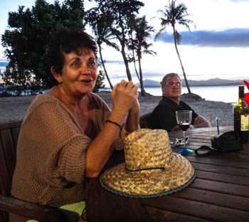
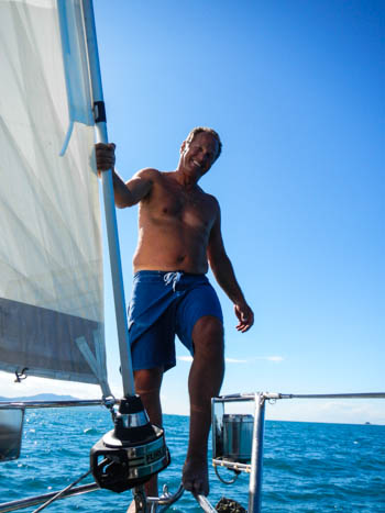
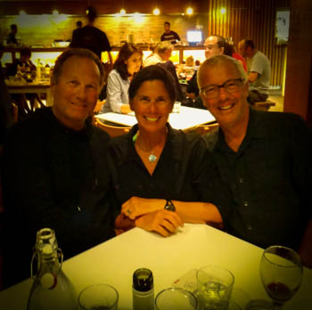
Jim's taking an online photography course. One exercise is to take a portrait using creative off camera flash. I'm really tired of his camera in my face and Steve is too nice to say no, so I held the flash and Jim snapped away.
July 3 - Hinchinbrook Channel
The southern entrance to Hinchinbrook Channel is quite shallow and we need to cross close to high water. HW today is at 0600. It's eight miles from Little Pioneer Bay so we're on our way at 0558.
Anxiously we watch the depth go from five meters to four to three. We draw two. Then 2.9, 2.8... We still have over a mile to go to reach the long jetty at which point the water deepens.
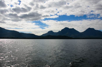
After what seems an eternity we reach the jetty. Whew, now the water is deeper as we follow the buoys alongside. The Hinchinbrook Channel runs between the mainland and steep, rugged Hinchinbrook Island. Aside from a small resort, the island is a national park. You can hike there but the tracks are not maintained.
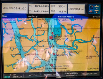
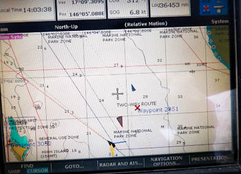
What a magical place! Dense green mountains rise on both sides of the 29 mile long channel. Arms branch off left and right and the chartplotter looks like a shot of veins, arteries and capillaries. White great egrets and Australian pelicans lounge at the shore beneath mangroves while terns fly above. There is not a croc in sight although there are many here. The water is flat calm but the current pushes us along giving us up to 2 knots extra SOG (speed over ground).
Yasi was a Category 5 Cyclone. It ripped though northern Queensland on February 3, 2011, making landfall at Mission Beach just across from Dunk Island. A five meter tidal surge came up the Hinchinbrook Channel. That's 2.3 meters above the Highest Astronomical Tide. Sections of dead mangroves attest to the destruction. Yasi also wreaked havoc on parts of the Great Barrier Reef.
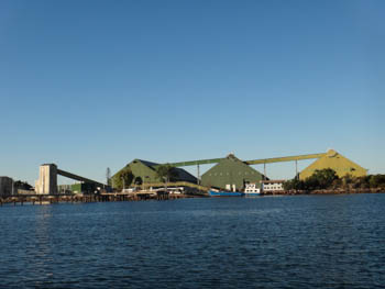
The town of Cardwell is located at the northern end of the channel. It was hit hard and the marina was completely demolished. Rebuilding is underway but there's a long way to go.

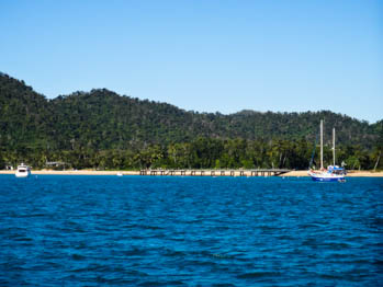
July 3 - Dunk Island
17 56'.02 146 07'.88E
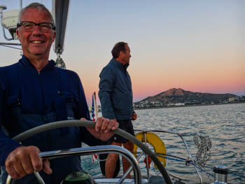
We make good time through Hinchinbrook Channel and cover 63 miles by 1500. Since we plan to leave before dawn, we anchor at Dunk Island behind the other boats. I see Dreamchaser, a boat owned by a woman I met through Shelley, a mutual friend. Jim and Steve lower the dinghy so I can say G'day. I'm so glad Steve's here to help with these chores!
Melinda and Glenn are cooking steak for lunch when we arrive. Steve's head tilts back, nostrils flare and eyes focus on the grill where the carnivorous treat smokes. It smells delicious in that searing meat kind of way. I feel bad I only made him a PB&J for lunch. He needs beef, I see it in his eyes.
We're keen to go snorkeling but Melinda and Glenn didn't know exactly where to go. They say people have been swimming at the sandy beach by the pier so it's probably safe.
"Safe from what?" I ask.
"Crocodiles. They don't go where people are."
"I wouldn't swim off your boat though," Glenn adds, "You're out there by yourselves."
"Will they go that far out?" I ask.
"They swim to the reef!" exclaimed Melinda.

We say good-bye so they can have lunch. Glenn suggests we move in closer and Melinda invites us to join them on shore for sunset.
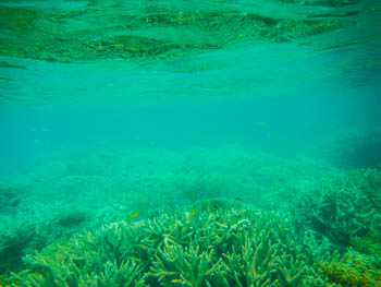
We head off to the beach to ask about snorkeling. A couple of young girls say it's good off the rocky point and off the tiny island. The island is closer. I tell Steve I'll go in the water if he wants to. There's no way Jim's going in.
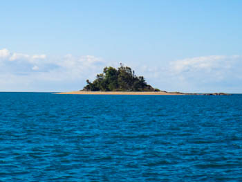
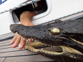
When we get to shore I see a sign warning people not to land between October and March when birds are nesting. We are the only ones here. If I were a crocodile I'd be really happy here. No people to bother me until someone walks up the beach. Then I can run over, grab a leg, roll around, and eat them.
"Sorry, I've got a really bad feeling about this," I tell Jim and Steve. "I don't want to go in the water and I don't want to be here on this island. I want to get out of here. Now." Jim understands. Steve looks at me like I'm crazy. We go back to the boat.
Jim and I go ashore to meet Melinda and Glenn. Steve stays on board and curls up with his kindle. We have a lovely evening talking about the area, sailing and Melinda's online magazine, Sailors' Paradise. Glenn is a marine engineer and has lots of great tips. Our favorite: If you need an O ring just make some wraps of self-amalgamating tape around something the correct diameter, a finger, pencil, etc. and then roll it down. Brilliant!
July 4 - Fitzroy Island
16 55'.65S 145 59'.29E
It's rained off and on all night and it's drizzling when we haul up the anchor at 0556. Jim tells me to take a nap below when I doze in the cockpit. I don't set my watch and wake up five hours later. I relieve him at 1300 and he's asleep at once.
We sail on a broad reach in 16-20 knots. Clouds reel in and out the visibility from a few miles to less than one. We are sailing up the big ship route. I'm not sure why. I watch as a tanker approaches from the south with a CPA (closest point of approach) of one mile. When I expand the view on the chartplotter, I see we are on a collision course with a cargo ship coming from the north. CPA is .0017. I turn away but can only go so far, there are rocks and islands. When Tenaya is less than a mile off the rocks, the tanker passes at one mile. The cargo ship passes between us.
There is a public mooring near the pier at Fitzroy Island but a catamaran is on it. It can be used for two hours during the day and whoever is on it at 1700 can stay until 0900 the following morning. We'd hoped to snag it. Oh well.
A narrow shelf about 5 meters deep runs outside the reef before it drops to 12 and deeper. The shelf is full so we anchor in 13 meters. It's close enough to the reef and far enough from the pier with ferry loads of daytrippers.
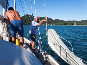
Jim and I have new prescription masks and he hasn't tried his yet. The next morning he collects his snorkeling gear and paddles the kayak to shore while Steve and I plan to swim from the boat.
As we're getting ready Steve points to something floating in the water. It looks exactly like a croc's head. I wait as it swims close to Tenaya, against the current. It's got to be a croc, it's got the right shape. I'm only convinced otherwise when there is no body and the driftwood floats by.
Steve gets in the water and fins towards shore. I'm scared. Normally I jump in from mid-ships but today I step down to the first step careful not to splash. I slowly squat down to look under the boat. Nothing. I look around again. All clear. I check one, two, three more times under the water before I drop into the water, push off and fin as hard as I can to Steve. My heart is racing. Steve is laughing, says I looked like a little girl. I don't stop to listen.
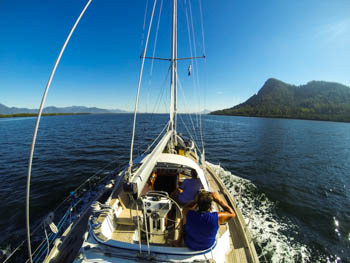
At 1300 we raise the anchor and sail 19 miles to Cairns. The conditions are ideal! We're on a broad reach with 13-20 knots and warm and sunny skies. Tenaya is on autopilot and we're moving from spot to spot soaking up the sun. It's the perfect 'last sailing day' for Steve.
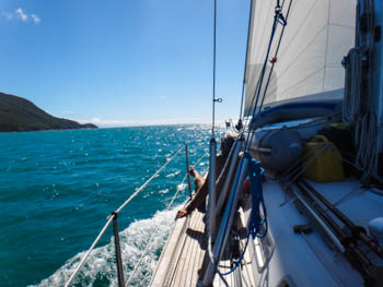
As we round the point and sail towards the marked channel, I push the button to turn us 10 degrees into the wind. Then another 10. Both sails are open fully. We don't do that often.
Sure enough, a 22 knot gust smacks us forward of the beam. We heel hard. Not a good time for Jim to be stretched out in the sun across the back deck. Steve's propped up on the combing. I rush behind the wheel, switch off the autopilot and steer us more downwind. Jim hops up to help reef. Steve thinks it's finally exhilarating. I'm thankful nobody goes overboard.
July 5 - Marlin Marina, Cairns
Berth B4 - 16 55'.23S 145 46'.87E
Yippee! We made it to Cairns with a few days to spare before Steve's flight back to California. We can go diving!


And we can go to restaurants! This marina is in the heart of Cairns with several great spots along the marina promenade and more on the nearby Esplanade.
Go to July 2013 Part Four - Diving the Great Barrier Reef